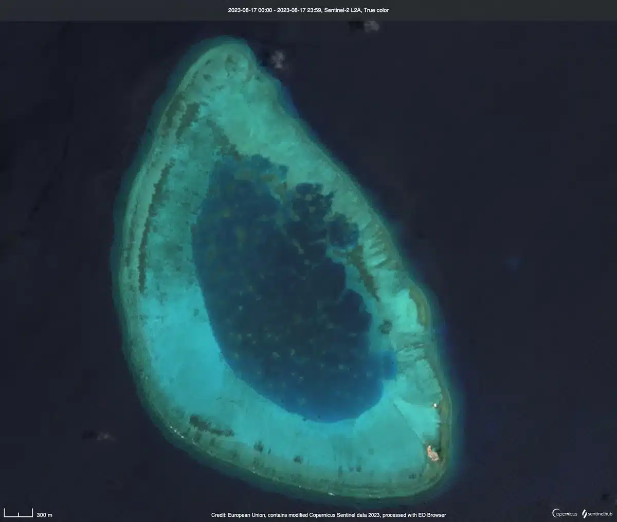
China has completed the first phase of construction on Antelope Reef in the Paracel Islands, transforming a submerged reef into a 1,500-acre artificial military island in the disputed South China Sea, according to satellite imagery reviewed by Reuters on August 19, 2026. The rapid transformation, accomplished in less than a year, showcases Beijing’s accelerated land-reclamation capabilities and marks the first major island-building project in the region since 2017.
The island, known as Lingyang Jiao in Chinese, now spans roughly 3.7 miles in length and is surrounded by seawalls and internal roads. Satellite images show a 680-meter quay capable of berthing military and civilian ships, a deep-water harbor, and preparations for a 10,000-foot runway on the northwestern side of the island. A helicopter pad, administrative buildings, and housing structures are already in use on the eastern part of the island, with two concrete plants supporting ongoing construction efforts.
The scale of the project is striking. In less than a year, the People’s Republic of China dredged more than a million tons of sand from the seabed to create the landmass. According to the Asia Maritime Transparency Initiative at CSIS, Antelope Reef’s 1,490-acre footprint now rivals Mischief Reef, China’s largest artificial outpost in the entire South China Sea, and far exceeds Woody Island, the Paracels’ previous largest feature at 890 acres.
The pace of construction represents a dramatic acceleration compared to China’s earlier island-building campaigns. The artificial islands in the Spratly Islands, built nearly a decade ago, took several years to complete; Antelope Reef was dredged and shaped in months. Dredging vessels, which had arrived with their transponders dark to avoid detection, departed after completing the first phase, according to reporting from The War Zone.
Strategic Importance and Military Positioning
Analysts view Antelope Reef as a critical addition to China’s military infrastructure in the South China Sea. Located approximately 160 nautical miles south of Hainan and 200 nautical miles east of Da Nang, Vietnam, the island sits in a strategically vital position near major Chinese naval installations including the Yulin Naval Base, home to two of the People’s Liberation Army Navy’s three aircraft carriers.
According to Ben Lewis, founder of the open-source data platform PLATracker, the reef’s location is exceptionally important in a potential Taiwan conflict scenario. “The northern part of the South China Sea would be particularly important in a Taiwan conflict scenario, so Antelope is ideally placed,” Lewis told Reuters. The facility could extend China’s radar and electronic surveillance coverage, provide an additional dispersed airfield for military sorties, and offer another port for naval operations.
China’s defense ministry has not acknowledged the construction as military in nature. State media have stated that Antelope will serve civilian needs such as weather forecasting and scientific research—a claim that mirrors explanations given during construction of China’s other artificial islands in the South China Sea. However, regional security analysts and military attaches say the facility is more likely to strengthen China’s military hold on the northern part of the waterway.
Greg Poling, senior fellow at AMTI, emphasized the intelligence and surveillance value of the project. “I have no doubt that this marginally benefits China in that it’ll be able to forward deploy more Coast Guard and more militia in the Paracels persistently,” Poling said on the Why Should We Care About the Indo-Pacific podcast. “But the main benefit is probably the ISR—Intelligence, Surveillance, Reconnaissance—component; the ground-based sensing you get just building stuff.”
The Paracel Islands remain disputed territory. China has occupied the archipelago since 1974, but Vietnam and Taiwan also claim sovereignty over the islands. Vietnam’s foreign ministry has previously asserted its claims, saying in March 2026 that it “resolutely opposes such actions” and has made formal representations to Beijing.
Sources
- Reuters — China’s completion of the first phase of construction, satellite imagery analysis, strategic significance, and expert commentary from Ben Lewis and Carl Thayer
- The War Zone — Construction timeline, scale of dredging (over a million tons of sand), satellite imagery details, runway specifications, and quay dimensions
- Asia Maritime Transparency Initiative (CSIS) — Acreage measurements (1,490 acres), comparison to other Chinese outposts, and runway construction details
- Institute for the Study of War — August 21, 2026 satellite imagery confirmation and construction phase completion