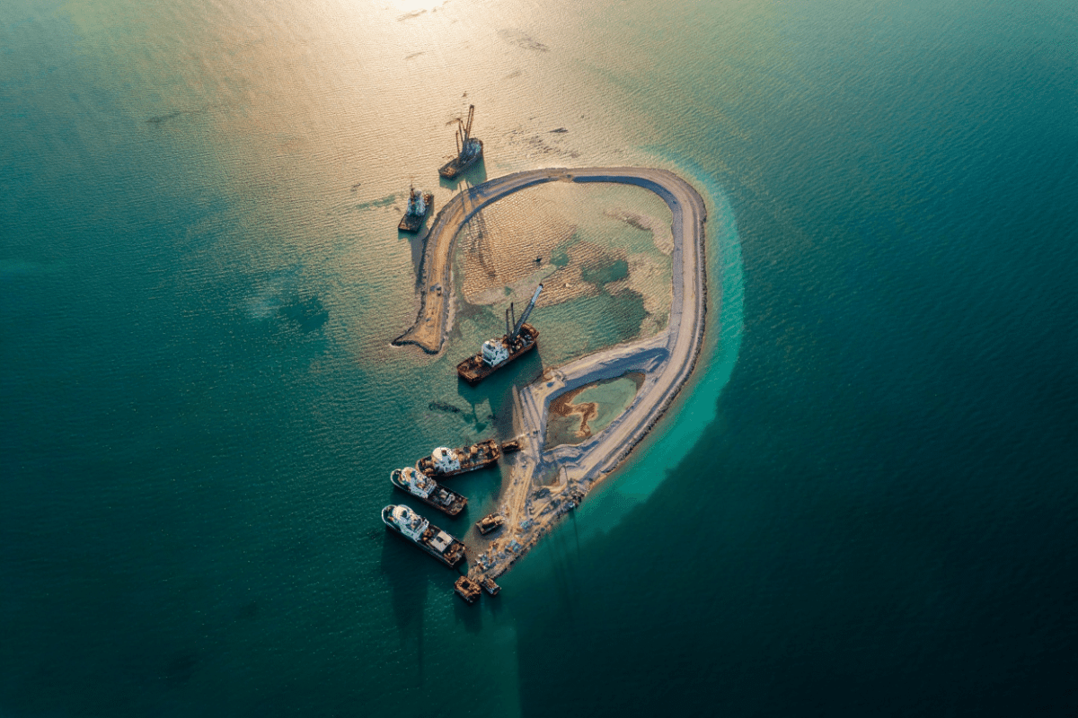
Reuters satellite imagery reveals China is rapidly expanding its military presence in the South China Sea with a massive construction project at Antelope Reef that could become the region’s largest artificial island. The project, which commenced in November 2025 and accelerated through May 2026, demonstrates Beijing’s strategic commitment to establishing permanent military infrastructure in contested waters and raises significant geopolitical implications for US-China security competition and regional maritime stability.
🔥 Quick Facts
- Construction began November 2025 at Antelope Reef in the Paracel Islands
- Crescent-shaped island designed for 2,700-meter military runway capability
- Estimated 15+ square kilometers of land reclamation completed as of late May 2026
- First major project since China’s pause around 2015-2016 in South China Sea island-building
- $50 billion total investment in SCS military infrastructure (Hainan & region as of 2022)
Strategic Context: China’s South China Sea Military Expansion Timeline
China’s artificial island construction in the South China Sea represents a decade-long strategy to establish military dominance over contested waters claimed by multiple nations. From 2013 to 2015, Beijing invested heavily in dredging and landfill operations, creating 3,200 hectares of artificial terrain across seven major island features in the disputed region.
After a period of relative restraint from 2016 to late 2025, China has resumed aggressive construction at Antelope Reef—a previously submerged feature in the Paracel Islands that satellite analysts now describe as the most strategically significant expansion since the mid-2010s. This resumption signals Beijing’s willingness to escalate military positioning despite international pressure and evolving US Indo-Pacific strategy.
Antelope Reef: Scale, Speed, and Strategic Purpose
NewYork Times satellite imagery from November 2025 through April 2026 documents the transformation of Antelope Reef from a shallow underwater feature into a fortified military outpost. Asia Maritime Transparency Initiative (AMTI) analysis indicates the island could become China’s largest feature in the Paracels and potentially across the entire South China Sea.
The construction employs dredging vessels and landfill operations to reclaim approximately 15 square kilometers of new land—a pace of development that accelerated from December 2025 through May 2026. Satellite analysts confirm the island’s design accommodates a 2,700-meter runway, sufficient for heavy military transport aircraft, bombers, and air superiority fighters. The crescent shape and orientation suggest hosting radar facilities, missile storage, and fuel depots—standard components of China’s militarized island network.
Comparative Infrastructure Analysis: Regional Military Balance
The Antelope Reef expansion must be understood within China’s broader military infrastructure portfolio in the region. As of 2025-2026, Beijing controls multiple island complexes with complementary military capabilities.
| Island Feature | Runway (meters) | Military Capability | Primary Purpose |
| Fiery Cross Reef | 3,250m | Heavy aircraft ops | Air defense, refueling |
| Mischief Reef | 3,000m | Combat aircraft | Fighter squadron ops |
| Subi Reef | 3,000m | Bomber/transport | Patrol & surveillance |
| Antelope Reef (under construction) | 2,700m (target) | Heavy bombers/transport | Northern defense & power projection |
This network creates overlapping air defense coverage and extends China’s radar horizon across the South China Sea. The expansion of military infrastructure reflects broader US-China strategic competition for regional dominance and command of critical sea lanes through which $5 trillion in global commerce transits annually.
“After nearly a decade of relative pause, China has resumed large-scale island-building in the South China Sea. Satellite images of Antelope Reef show a once-submerged feature rapidly transformed into what could become one of Beijing’s largest outposts in the region.”
— Lowy Institute analysis, April 2026
Geopolitical Implications and Regional Response
Taiwan, the Philippines, and US military planners view Antelope Reef as a strategic pivot point. The Paracel Islands sit northeast of the Spratly Archipelago, positioning enhanced facilities there to control shipping lanes toward Taiwan and Japan. Vietnam, which claims the Paracels, and Philippines officials have protested the construction, yet lack military capacity to challenge Beijing’s activities.
The US Navy has conducted multiple freedom of navigation operations in contested waters and increased Indo-Pacific presence deployments in response to Chinese militarization. Defense analysts warn that Antelope Reef’s completion would enhance Beijing’s capacity to enforce air and sea control, potentially restricting US operations and intimidating regional allies.
What Remains Uncertain About China’s Long-Term Strategy?
Several critical questions shape assessments of Antelope Reef’s ultimate strategic purpose. Will Beijing proceed with permanent stationing of H-6 bombers or remain focused on surveillance and air defense? How will accelerated construction trigger response escalation from the United States, Japan, or ASEAN states? And does the Antelope Reef project signal a broader resumption of China’s island-building for other contested reefs, potentially across the Spratlys?
These dynamics underscore why South China Sea militarization remains a defining economic and security concern for US policy makers, affecting trade routes, regional investment flows, and the balance of military power in the Indo-Pacific—a region home to over 4 billion people and responsible for approximately 30 percent of global maritime trade.
Sources
- Reuters — Satellite imagery analysis of South China Sea military facilities and deployment timelines
- New York Times (April 2026) — Interactive satellite documentation of Antelope Reef construction progression
- Asia Maritime Transparency Initiative (CSIS) — Expert analysis of military capability and infrastructure scale
- Lowy Institute (April 2026) — Geopolitical assessment of resumption of island-building
- Wall Street Journal (April 2026) — Strategic context on Antelope Reef military purpose and regional response
- Australian Broadcasting Corporation (July 2025) — Documentation of 3,200-hectare network and nuclear-capable systems
- Washington Post (October 2024) — $50 billion infrastructure investment valuation